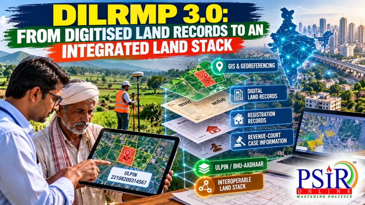
Land administration is one of the most complex areas of public governance in India. Land records influence agricultural credit, property transactions, inheritance, taxation, infrastructure development and access to welfare schemes. Yet information about a single parcel may be distributed across revenue records, cadastral maps, registration offices and court proceedings. Differences between these records and the actual position on the ground can create administrative delays and ownership disputes.
The Digital India Land Records Modernisation Programme (DILRMP) 3.0 seeks to address these challenges by moving beyond the digitisation of individual records towards an integrated digital framework for land administration. The Union Government launched its operational guidelines on 10 September 2026, with an approved outlay of ₹565.50 crore for 2026–2031. The programme proposes a GIS-enabled Land Stack connecting cadastral maps, Records of Rights, property registrations and relevant court information. It also emphasises georeferencing, Bhu-Aadhaar or the Unique Land Parcel Identification Number (ULPIN), and the modernisation of registration services.
The governance significance of DILRMP 3.0 lies in the shift from making land records digitally accessible to making land-related information more accurate, connected and useful for administration. However, an important distinction must be maintained: a digitised land record is not automatically proof of undisputed ownership. The programme’s success will depend on record accuracy, legal processes, state-level implementation and the resolution of existing disputes.
FROM DILRMP TO DILRMP 3.0: WHAT HAS CHANGED?
The National Land Records Modernisation Programme was launched in 2008. In 2016, it was restructured and integrated with existing land-record computerisation and registration initiatives to form DILRMP. Its earlier phases concentrated on computerising Records of Rights, digitising cadastral maps, computerising Sub-Registrar Offices and integrating registration with revenue administration.
DILRMP 3.0 builds on this foundation. Instead of treating each digitised database as a separate achievement, it seeks to connect different layers of land-related information through a common digital architecture.
|
Component |
What it seeks to do |
Governance relevance |
|
GIS-enabled Land Stack |
Connect land maps, Records of Rights, registrations and relevant court information. |
Supports integrated access to land-related information. |
|
Bhu-Aadhaar (ULPIN) |
Assign a 14-digit identifier to a land parcel using georeferenced parcel coordinates. |
Helps distinguish and identify individual land parcels. |
|
Georeferencing and cadastral maps |
Link mapped land boundaries with geographic coordinates. |
Can improve spatial accuracy and support verification of parcel boundaries. |
|
Registration Repository |
Organise registered deeds and encumbrance information for transaction history and due diligence. |
Helps officials and buyers examine available transaction-related information. |
|
Modern Registration Seva Kendras |
Upgrade 75 high-footfall Sub-Registrar Offices with improved citizen services and digital queue management. |
Seeks to improve the registration experience. |
|
Integration with revenue courts |
Connect the Revenue Court Case Management System with land records. |
Can support access to relevant case information and mutation-related proceedings. |
|
Urban land mapping |
Expand the NAKSHA initiative for GIS-based urban land records and Urban Property Cards. |
Addresses land-information needs in urban areas. |
These components are specified in the September 2026 launch announcement. They describe the programme’s design and intended functions; they should not be read as evidence that every component is already fully operational across India.
The change is therefore both technological and administrative. DILRMP 3.0 aims to connect records maintained by different authorities while preserving the respective ownership and control of data with the concerned authorities.
UNDERSTANDING THE LAND STACK, GIS AND BHU-AADHAAR
The central concept of DILRMP 3.0 is the Land Stack: an integrated framework that brings together different land-related datasets and makes them accessible through interoperable digital systems.
Under the proposed architecture, states would develop their own Land Stacks by connecting existing databases and services through application programming interfaces (APIs). These state-level systems would form the building blocks of a National Land Stack, designed to enable information exchange while retaining data ownership and control with the relevant authorities.
Consider a property transaction. Information about the parcel’s mapped boundaries may be held in a cadastral map; details about the recorded holder may appear in the Record of Rights; the sale deed may be held by the registration department; and a dispute may be pending before a revenue court. If these systems remain disconnected, officials and citizens may have to approach multiple offices to assemble the relevant information.
A connected Land Stack could allow authorised users to examine these layers together. It could support verification, transaction due diligence, administrative coordination and the identification of inconsistencies. However, the information displayed would still need to be checked against the applicable records, legal requirements and decisions of competent authorities.
Bhu-Aadhaar, or ULPIN, provides another building block. The Department of Land Resources describes ULPIN as a 14-digit identifier generated using the geographic coordinates of a land parcel and dependent on detailed surveys and georeferenced cadastral maps. It is intended to provide a standardised way of identifying individual parcels.
A unique parcel identifier can help distinguish one parcel from another, support land accounting and facilitate the exchange of information between systems. But it does not, by itself, establish who legally owns the parcel, whether its boundaries are disputed or whether a transaction is valid.
The distinction is fundamental: ULPIN identifies a parcel; ownership must still be established and verified through the applicable legal and administrative framework.
DIGITISATION, LAND TITLES AND THE PROBLEM OF DISPUTED OWNERSHIP
India’s land administration system has historically relied on several kinds of records, including registered deeds, Records of Rights, survey documents and property-tax records. These documents serve different purposes and may be maintained by different authorities.
In its August 2026 review of DILRMP, the Parliamentary Standing Committee on Rural Development and Panchayati Raj highlighted the continuing need to complete surveys and resurvey, integrate textual records with maps, preserve legacy documents and improve the functioning of record rooms. It also discussed the delays and discrepancies that can arise when registration and mutation remain separate processes.
This matters because digitisation changes the format and accessibility of information, but does not necessarily correct the information itself.
For example, an old cadastral map may contain an inaccurate boundary. Scanning it preserves the map digitally, but does not make that boundary accurate. Similarly, a Record of Rights may contain an outdated entry following inheritance or partition. Uploading that entry does not resolve the underlying discrepancy.
There is also a legal distinction between recording a transaction and guaranteeing ownership. India largely follows a system of presumptive titling: registration and land records provide important evidence, but they do not invariably amount to a government-guaranteed, conclusive title. A registered deed or revenue entry may still be challenged where competing claims, defects in the chain of title or other legal issues arise.
DILRMP 3.0 can improve the information available to citizens and authorities, but it should not be presented as having automatically introduced conclusive land titling nationwide. Stronger title security requires accurate surveys, reliable historical records, timely mutation, accessible correction procedures and effective adjudication of disputes.
The objective should be to use digital systems to support legal certainty—not to allow a database entry to substitute for due process.
COOPERATIVE FEDERALISM AND THE CHALLENGE OF INTEROPERABILITY
Land administration involves both Union-level digital infrastructure and state-level institutions responsible for land and revenue administration. States differ in their land laws, record formats, registration practices, survey systems and administrative procedures. Integrating these systems therefore requires more than a common software platform.
DILRMP 3.0 proposes a federated model in which states develop their own Land Stacks and connect them to a broader national framework. The programme provides for 100% central funding and phased, performance-linked implementation across states and Union Territories, with progress monitored through an upgraded DILRMP-MIS dashboard.
This model seeks to combine national interoperability with state-level control of data. Its effectiveness will depend on several conditions:
· Common technical standards: States need compatible formats, identifiers and protocols for exchanging information.
· Reliable interdepartmental coordination: Revenue, registration, survey and judicial information systems must be updated consistently.
· Clear responsibility for errors: Authorities need defined procedures for correcting discrepancies and identifying the department responsible for a record.
· Respect for local land systems: Customary and community land arrangements cannot simply be forced into individual-ownership formats without appropriate legal and institutional safeguards.
The Parliamentary Standing Committee specifically highlighted challenges in Sixth Schedule areas, where community land ownership, customary practices and the role of Autonomous District Councils require a dedicated implementation strategy developed in consultation with state governments and traditional institutions.
This is an important reminder that interoperability should not mean uniformity at the expense of local institutions. A national digital framework must accommodate legitimate differences in land tenure and administration.
The theoretical connection is cooperative federalism: the Union can provide financial and technical infrastructure, while states retain essential responsibilities for implementing land administration within their respective legal frameworks. The quality of coordination will determine whether a common digital architecture delivers consistent services without weakening state-level accountability.
IMPLEMENTATION PRIORITIES: ACCURACY, ACCESS AND ACCOUNTABILITY
DILRMP 3.0 has the potential to make land information easier to retrieve and more useful for administration. Realising that potential requires attention to the quality of records and the experience of citizens.
First, complete the integration of textual and spatial records. A Record of Rights should be linked to the correct parcel on the map. Discrepancies between mapped boundaries and recorded details need to be identified and resolved through appropriate procedures.
Second, preserve and verify legacy records. Historical deeds, survey records and physical files remain important where old entries are challenged. Digitisation should include systematic indexing, secure storage and procedures for consulting original records when required.
Third, improve mutation and dispute resolution. Registration should connect efficiently with the mutation process, while disputed cases must continue to receive proper scrutiny. Digital case tracking can improve visibility, but a faster workflow should not bypass hearings, evidence or the rights of competing claimants.
Fourth, protect privacy and prevent misuse. Land databases can contain personal and transaction-related information. Access should be governed by clear rules, with appropriate authentication, audit trails, cybersecurity measures and safeguards against unauthorised disclosure or fraudulent alteration.
Fifth, make services accessible. Online records and Registration Seva Kendras should reduce the practical burden on citizens, including people who lack digital literacy or reliable internet access. Assistance at local offices remains important where a citizen needs help correcting records or understanding the status of an application.
Finally, implementation should be assessed through meaningful indicators rather than digitisation totals alone. Useful measures include the proportion of cadastral maps linked to Records of Rights, the number of verified parcel identifiers, mutation-processing time, unresolved record discrepancies, the status of pending revenue cases, and citizen complaints about incorrect entries.
These indicators would help distinguish digital infrastructure created, services actually used and improvements experienced by citizens. A larger database is not necessarily a more accurate database, and a faster transaction is not necessarily a legally sound transaction.
UPSC ANGLES
|
Dimension |
Relevance to DILRMP 3.0 |
|
Constitutional and legal |
Highlights the relationship between property rights, lawful procedures, land records and the adjudication of competing claims. Article 300A protects property from deprivation except by authority of law. |
|
Governance and administrative reform |
Demonstrates the shift from isolated record computerisation to integrated digital public infrastructure. |
|
Cooperative federalism |
Examines how central funding and common technical standards can work alongside state control over land administration and records. |
|
Digital governance |
Connects GIS, ULPIN, APIs and federated data systems with interoperability, service accessibility and record accuracy. |
|
Social justice |
Raises concerns about inherited land claims, small and marginal farmers, community landholders and citizens who may struggle to correct inaccurate records. |
|
Economic development |
Reliable land information can support property transactions, agricultural credit, infrastructure planning and due diligence, subject to legal verification. |
|
Institutional accountability |
Requires clear responsibility for record corrections, timely mutation, transparent case status and effective grievance redressal. |
|
Tribal and customary rights |
Shows why Sixth Schedule and community land systems require consultation and context-sensitive implementation. |
|
Implementation evaluation |
Encourages the use of indicators for spatial accuracy, text-map integration, dispute resolution and citizen experience instead of relying only on digitisation percentages. |
CONCLUSION
DILRMP 3.0 represents a significant evolution in India’s approach to land administration. Its proposed Land Stack, georeferenced cadastral maps, ULPIN, Registration Seva Kendras and integration with revenue-court information seek to connect records that have often operated across separate administrative systems.
The programme’s success, however, will not be determined solely by the number of records digitised or parcel identifiers generated. It will depend on whether information is accurate, whether departments exchange and update data reliably, whether citizens can correct errors, and whether disputed claims are resolved through lawful procedures.
The real test of an integrated Land Stack is not whether every parcel has a digital identity, but whether that identity is linked to reliable records and fair, accessible land administration.
OFFICIAL REFERENCES AND FURTHER READING
GS2 MAINS PRACTICE QUESTIONS